
High Resolution Imaging Reveals Puzzling Features Deep in Earth’s Interior
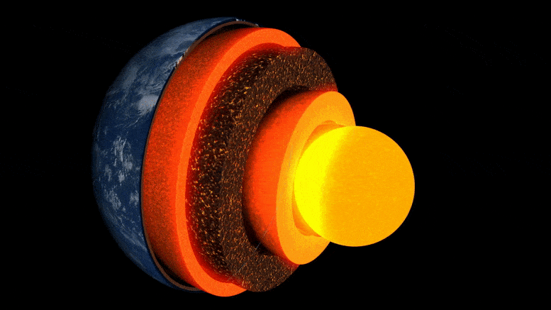
Animation of the Earth’s layers.
New research led by the University of Cambridge is the first to obtain a detailed ‘image’ of an unusual pocket of rock at the boundary layer with Earth’s core, some three thousand kilometers beneath the surface.
The mysterious area of rock, which is located almost directly beneath the Hawaiian Islands, is one of several ultra-low velocity zones – so-called because earthquake waves slow to a crawl as they pass through them.
The research, published on May 19, 2022, in the journal Nature Communications, is the first to reveal the complex internal variability of one of these pockets in detail, shedding light on the landscape of Earth’s deep interior and the processes operating within it.
“Of all Earth’s deep interior features, these are the most fascinating and complex.” — Zhi Li
“Of all Earth’s deep interior features, these are the most fascinating and complex. We’ve now got the first solid evidence to show their internal structure — it’s a real milestone in deep earth seismology,” said lead author Zhi Li, PhD student at Cambridge’s Department of Earth Sciences.
Earth’s interior is layered like an onion: at the center sits the iron-nickel core, surrounded by a thick layer known as the mantle, and on top of that a thin outer shell — the crust we live on. Although the mantle is solid rock, it is hot enough to flow extremely slowly. These internal convection currents feed heat to the surface, driving the movement of tectonic plates and fuelling volcanic eruptions.
Scientists use seismic waves from earthquakes to ‘see’ beneath Earth’s surface — the echoes and shadows of these waves reveal radar-like images of deep interior topography. But, until recently, ‘images’ of the structures at the core-mantle boundary, an area of key interest for studying our planet’s internal heat flow, have been grainy and difficult to interpret.
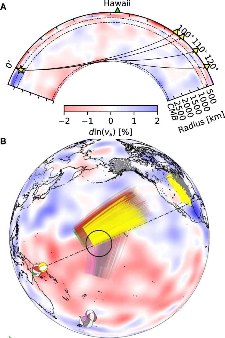
Events and Sdiff ray paths used in this study. A) Cross-section slicing the center of Hawaiian ultra-low velocity zone, showing ray paths of Sdiff waves at 96°, 100°, 110°, and 120° for 1D Earth model PREM. The dashed lines from top to bottom mark the 410 km, 660 km discontinuity, and 2791 km (100 km above the core–mantle boundary). B) Events and Sdiff ray paths on the background tomography model SEMUCB_WM1 at 2791 km depth. Beachballs of events plotted in different colors including 20100320 (yellow), 20111214 (green), 20120417 (red), 20180910 (purple), 20180518 (brown), 20181030 (pink), 20161122 (gray), stations (triangles), and ray paths of Sdiff waves at pierce depth 2791 km in the lowermost mantle used in this study. The event used in short-period analysis is highlighted in yellow. Proposed ULVZ location is shown in black circle. Dashed line shows cross-section plotted in A. Credit: Nature Communications, DOI: 10.1038/s41467-022-30502-5
The researchers used the latest numerical modeling methods to reveal kilometer-scale structures at the core-mantle boundary. According to co-author Dr Kuangdai Leng, who developed the methods while at the High Resolution Imaging Reveals Puzzling Features Deep in Earth’s Interior