
Minnesota Weather: After Wednesday Soaking, Snowfall Expected Early Friday –
WHAT WE KNOW
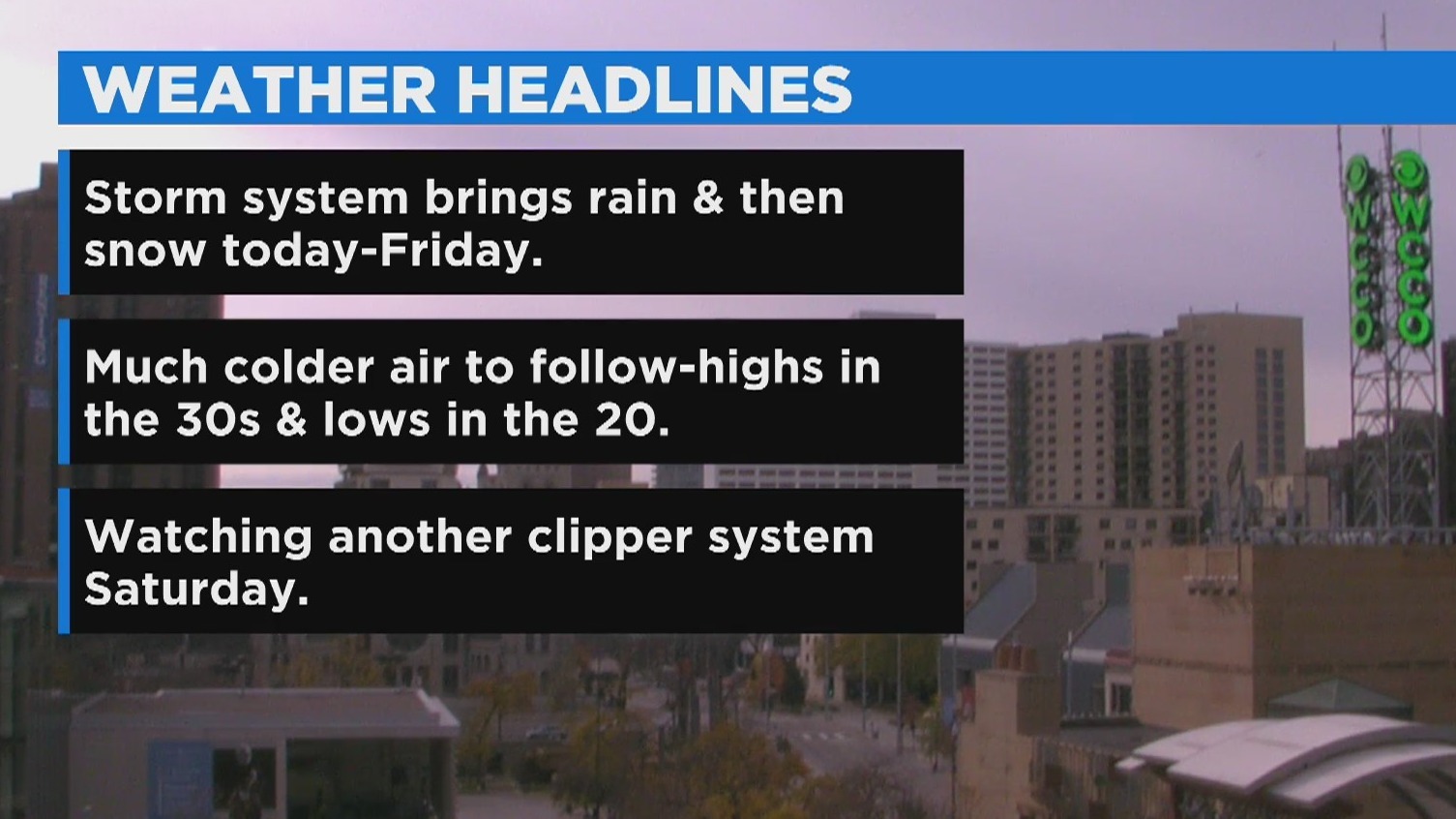
– First accumulating snow for northern Minnesota Thursday evening
– Soaking rain for most of Minnesota beginning Wednesday afternoon
– Strong winds Friday of 40+ mph could lead to visibility issues, especially to the west and north
– Much colder weekend to follow, with the possibility of more light snow on Saturday
WHAT WE DON’T KNOW
– When exactly wintry mix will turn to snow Thursday night into Friday morning
– How much snow will melt on impact
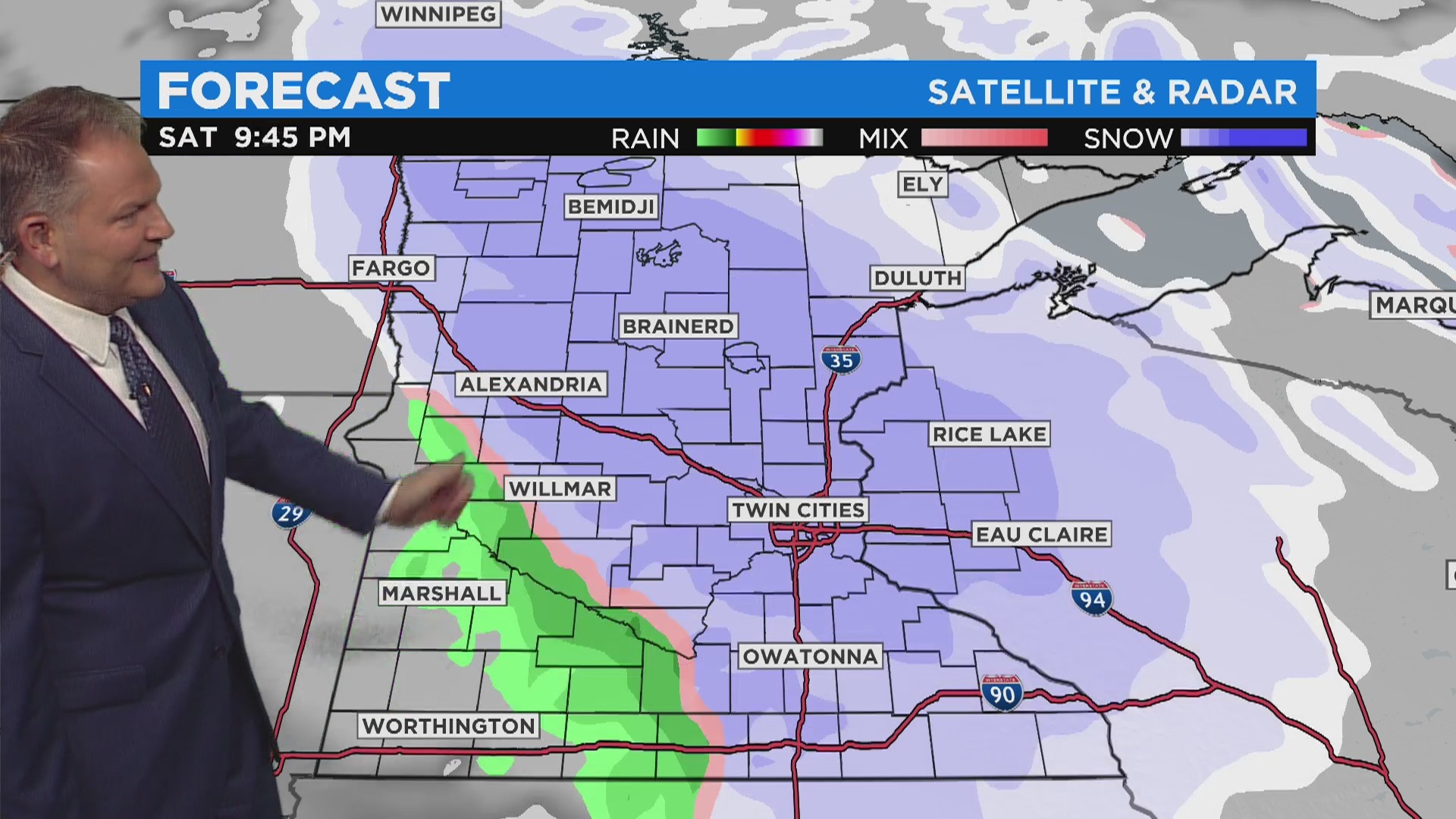
– How much snow will fall Saturday evening into Sunday
MINNEAPOLIS (WCCO) — The WCCO Weather watcher is green as rain is on the way Wednesday. Snow is also in the forecast for later this week.
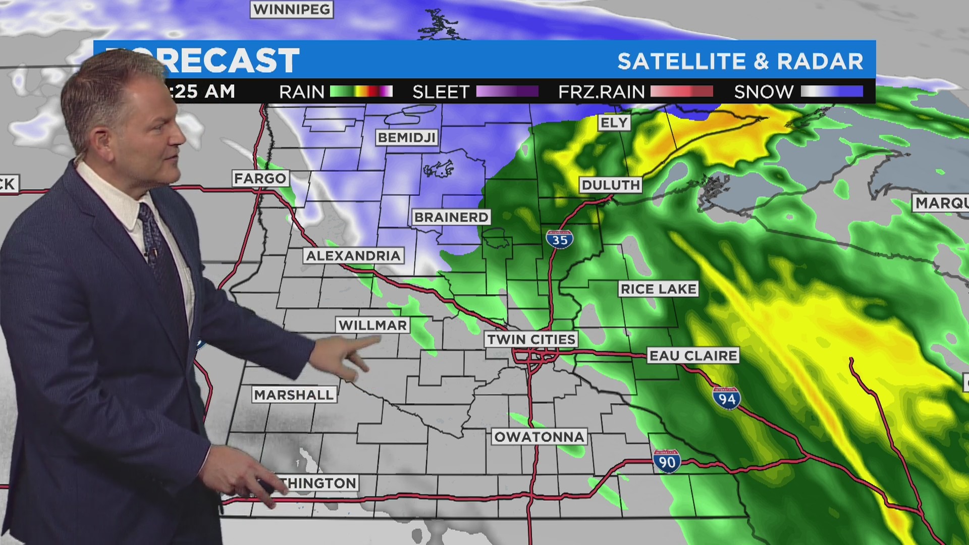
Rain will be moving into the state from west to east, with the Twin Cities expected to see precipitation from 4 p.m. to the overnight hours of Thursday. The metro area is expected to get a half-inch to three-quarters inch of rain, with lesser amounts recorded to the west.
Then, a wintry mix of rain and snow is expected late Thursday night for the Twin Cities, which will turn into snowfall Friday morning. Snow could stick around until the late afternoon.
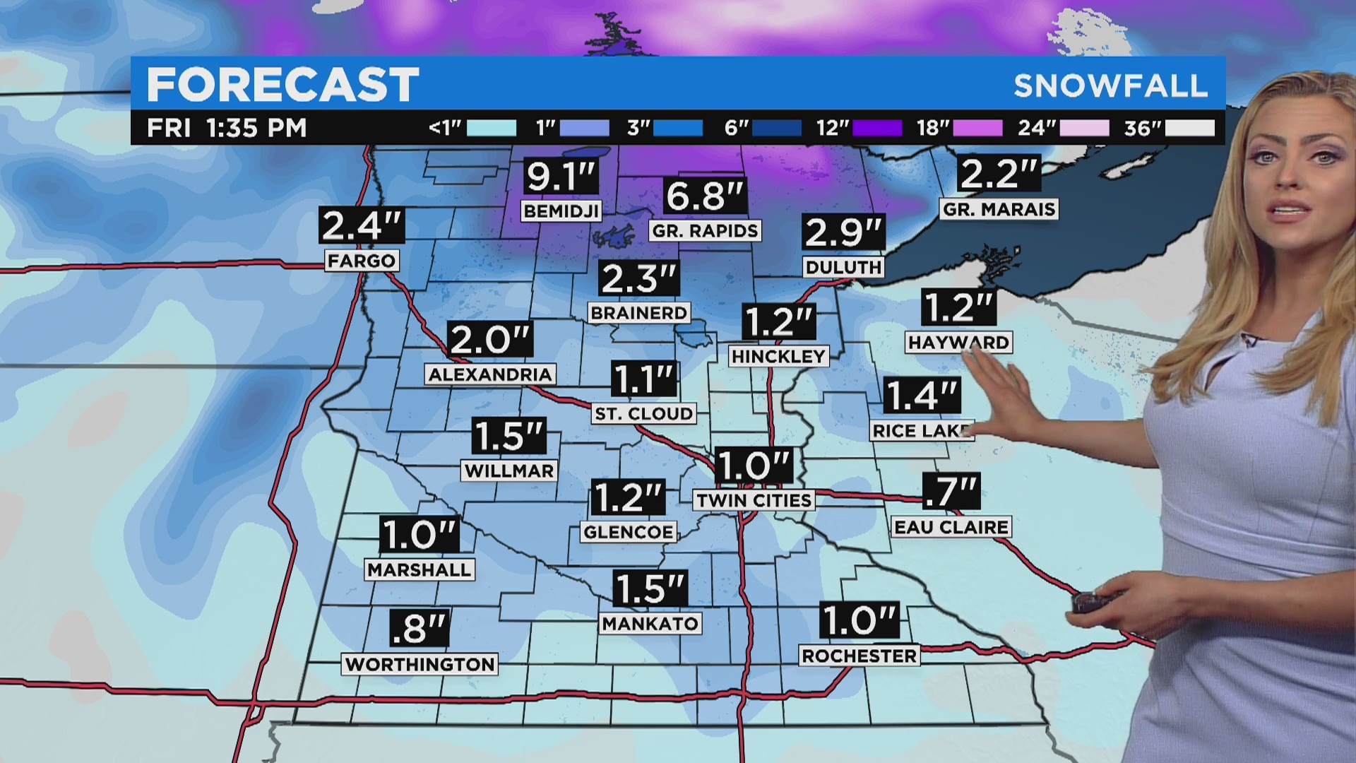
Snow accumulation isn’t expected to be much, with the Twin Cities getting a half-inch or less. Western Minnesota could see two to three inches. Northern Minnesota is expected to get around the same, or more.
However, northern areas like Bemidji and Grand Rapids could get six or more inches of snow. It’s not sure how much of that will melt on impact.
Strong winds will also be a factor Friday as wind speeds could be 40 mph or more, leading to visibility issues, especially western and northern Minnesota.
Then, a much colder weekend is in store. More light snow could be possible Saturday.
Today: Cloudy & PM Rain, low 50s.
Tonight: Rain & low 40s.
Read previous version of the story below.
MINNEAPOLIS (WCCO) — Temperatures in the Twin Cities will be cooler Wednesday, but still mild, and steady precipitation is on the way.
WCCO Chief Meteorologist Chris Shaffer says a storm system is on track to enter Minnesota Wednesday afternoon, drenching much of the state with steady rainfall through the day. The system is expected to hit the Twin Cities in the early evening, with rain continuing into Thursday morning.
On the back side of the system will be a blanket of cold air, which looks to settle over parts of northern Minnesota, bringing the potential for accumulating snow. According to Shaffer, a few inches of snow could stack up on grassy areas and side streets. Drivers will want to be prepared as this will mark the first real snow of the season.
(credit: CBS)
Closer to the Twin Cities, the cooler air Thursday will bring a wintry mix or light snow across central Minnesota. However, no accumulation is expected.
The cold air will usher in strong winds. Gusts between 20 and 40 mph are expected Thursday into Friday across Minnesota, with the strongest gusts likely along the western border and south-central Minnesota.
A second chance for light snow will come Friday for much of the state, but the precipitation could well change to a wintry mix near the Twin Cities, as air temperatures are expected to be in the upper 30s in the afternoon.
Read More: Minnesota Weather: After Wednesday Soaking, Snowfall Expected Early Friday –