
Tornadoes and severe weather threaten the South
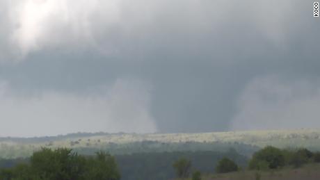
These types of tornadoes are ones that consistently remain on the ground for an extended period of time, unlike a typical one that could be on the ground for just minutes.
The system that will be responsible for these strong storms is currently impacting the Southwest, and will make its trek through the Rocky Mountains and eject into the Plains by midweek, allowing for an atmospheric set-up conducive for dangerous storms to form.
“We’ve got increasingly warm and humid air over the Gulf of Mexico that will lift rapidly northward — those large scale conditions are quite favorable for severe storms. We think some of the smaller details that we often see on higher end days, especially with significant tornado potential, will also be in place,” said Bill Bunting, chief of forecast operations at the SPC.
“This is a very strong system that we’ve been tracking the potential for severe storms as it develops and moves off to the northeast, from the Plains into the Ohio Valley,” meteorologist Jason Holmes at the NWS office in Birmingham, Alabama told CNN.
Timing out the storms
The threat for thunderstorms begins as early as Tuesday evening for much of Kansas, Oklahoma and northeastern and central Texas.
The highest risk, however, will likely be during the overnight hours of Tuesday and continuing into Wednesday morning. An isolated tornado will be possible, especially in central Oklahoma, but the main risks will be large hail and damaging winds.
There will also be a separate risk for a few strong storms across the South during the day Tuesday, including parts of Mississippi, Alabama and Georgia.
“Our real day of focus right now is Wednesday. We could see a fairly widespread severe weather threat and potentially some high-end severe thunderstorms,” said Bunting.
Wednesday into Wednesday night is forecast to be the most active day in terms of severe thunderstorms this week. There is currently a “Moderate Risk” for severe weather across eight states in the South, according to the SPC. A “Moderate Risk” is a level 4 out of 5 in terms of its potential severity. This includes Arkansas, Mississippi, Alabama and Tennessee.

The SPC said a “Moderate Risk” means “widespread severe storms are likely,” and all threats are possible in Wednesday’s set-up — tornadoes, large hail of at least golf ball size, and intense winds of at least 58 mph.
A morning round of showers and thunderstorms is currently forecast to move through parts of the Gulf Coast states. A few of these storms may be severe, but the main threat ramps up in the afternoon and continuing into Wednesday night.
During the afternoon hours, some of the states, especially in the “Moderate” or “Enhanced” risks, could see supercell thunderstorms develop. These types of storms are discrete, individual storms that are known for producing tornadoes. Not all of these storms will produce tornadoes, but given the favorable environment for tornadoes, it will be possible with some of them.

There will then be a final line of storms…
Read More: Tornadoes and severe weather threaten the South