
Satellite images appear to show China developing area along disputed border with
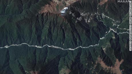
According to US-based satellite operator Maxar Technologies, the images, dated October 28, 2020, show “there has clearly been significant construction activity this year all along the Torsa River valley area.” In a statement, Maxar added there had also been construction of “new military storage bunkers” near the Doklam area.
In a statement, Bhutan’s ambassador to India, Major General Vetsop Namgyel, said “there is no Chinese village inside Bhutan.”
China’s Ministry of Foreign Affairs did not respond to CNN’s request for comment about the new images. India’s Ministry of External Affairs also did not immediately comment.
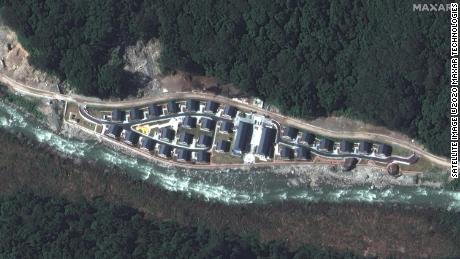
Just where the two countries draw their borders is highly disputed, however. The 2017 stand-off was sparked after Bhutan accused China of constructing a road inside its territory in “direct violation” of treaty obligations. China, which does not have formal diplomatic relations with Bhutan, denied the accusation, contending that the area is part of Chinese territory.
Read More: Satellite images appear to show China developing area along disputed border with